 "QUANTUM SHOT" #271
Link
Spectacular formation remains a puzzle
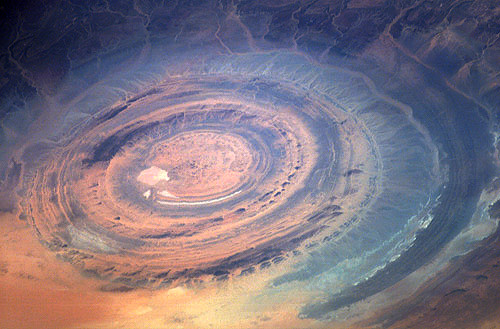
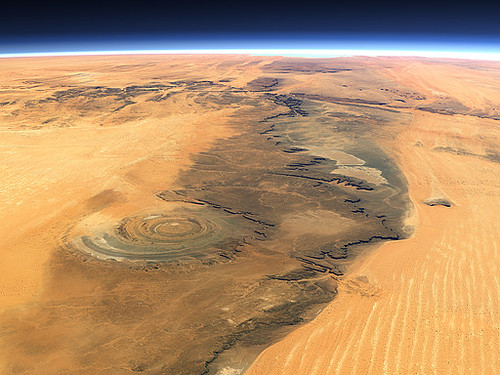
The Richat Structure, Oudane, Mauritania, is not really a structure but a huge circular formation (50 km in diameter - 30 miles), that resembles an eye when looked upon from space. Originally thought to be a crater, this volcanic dome is most likely a product of erosion, an ancient geological artifact in the middle of featureless Maur Adrar desert, in Africa's Western Sahara. The earliest space missions used it as a landmark, the adventurous 4x4 enthusiasts consider it to be their playground, and scientists are still debating its origin.

The Google Maps coordinates are 21.124217, -11.395569
View Larger Map
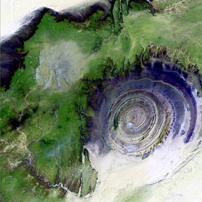
If you unzoom, you can distinctly see the eye:
View Larger Map
We even found some Photoshop of this eye, combining it into an Optimus Prime-like face:
(image credit: Lebovski)
The meteorite impact theory could not explain the flatness of the "crater"'s floor, so the most accepted explanation is the erosion of the initial volcanic dome, which gradually peeled away the layers of rock, creating the present onion-like form.
This image was taken by an Expedition 15 crew member on the International Space Station. (via Space.com)
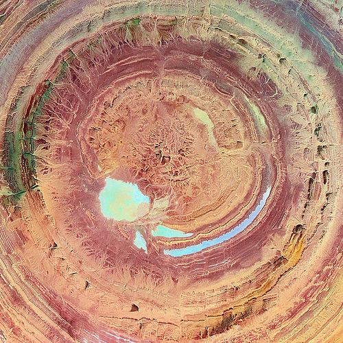
The following picture must have simulated color, for it looks almost like a fantastic lake:
(image credit: United States Geological Survey - USGS)
"Paleozoic quartzites form the resistant beds outlining the structure." (GSA Journals) A couple of other simulated images to illustrate that:
The topographical 3-D relief image, found on Wikipedia, shows "Le Guelb ri Richat" in most detail (The view is exaggerated six times vertically, the colors are slightly enhanced):

Here is a portion of this visualization, looking like landscape on some other planet:
Credit: NASA/JPL/NIMA
Johnnie Shannon image-enhanced the satellite image, clearly showing an eroded circular anticline (structural dome) of layered sedimentary rocks:
and Christoph Hormann created a spectacular view, using various modeling software:
(see more on his site)
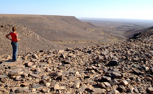
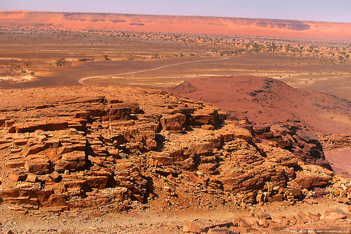
Barren landscape is a welcome challenge to 4x4 enthusiasts
You might think that this area is so remote and hostile that hardly anyone visits there. You would be quite wrong. There are companies offering organized tours, especially of the off-roading variety. Manfred Schweda from This Fab Trek has some good imagery of such journeys:

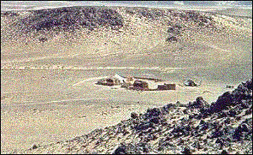
Surprisingly, there is also a hotel smack in the middle of the Richat Structure. It's nothing luxurious, but adequate accommodations to the tired "Mad Max" kinds of tourists:
The Longest Train in the World
The area around "the guelb" is interesting as well: F'Derik, one of the biggest iron mines in the world is located about 100 miles southeast. The iron ore produced there is exported all the way to the Atlantic port of Nouadhibou, via a 419-mile (674-kilometre) railway, which is the longest non-stop railroad in the world... (no passengers allowed).
The train from Nouadhibou to Choum is the longest train in the world. Its chain of cars can be up to three kilometres long.

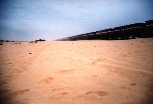
(images credit: Mauritania Travel Diaries)
Similar fun with Google Maps
To give you a taste of exploring Google satellite imagery, there is a site IntrepidEarth displaying the most unusual sightings. The following image of "Earth face with an iPod" is located in Alberta, Canada (Long/Lat: 50.01,-110.11):
View Larger Map
It turns out our planet has many faces, eyes, noses, ears and anything you can imagine - if you look hard enough. Truly fascinating sculptures of Nature.
(images credit: NASA/GSFC/MITI/ERSDAC/JAROS, and U.S./Japan ASTER Science Team)
Permanent Link...


Category: Nature,Travel
Related Posts:
Bolivian Salt Lake
Dry Valleys of Antarctica
Dark Roasted Blend's Photography Gear Picks:


0 comments:
Post a Comment